
01 / Source & preparation
Public / source data → raw DTM → mosaic → clip → reproject → prepared DTM. We document the source, available coverage, coordinate system and agreed delivery resolution.
GEOSCREENING / Services
Discover the coverage for free. Commission only the data preparation, terrain processing or expert analysis you need.
FREE DATA DISCOVERY
Use the Romania viewer to explore available coverage and define an area of interest. Access to discovery and visualisation is free. Professional preparation, processing and interpretation are optional services.
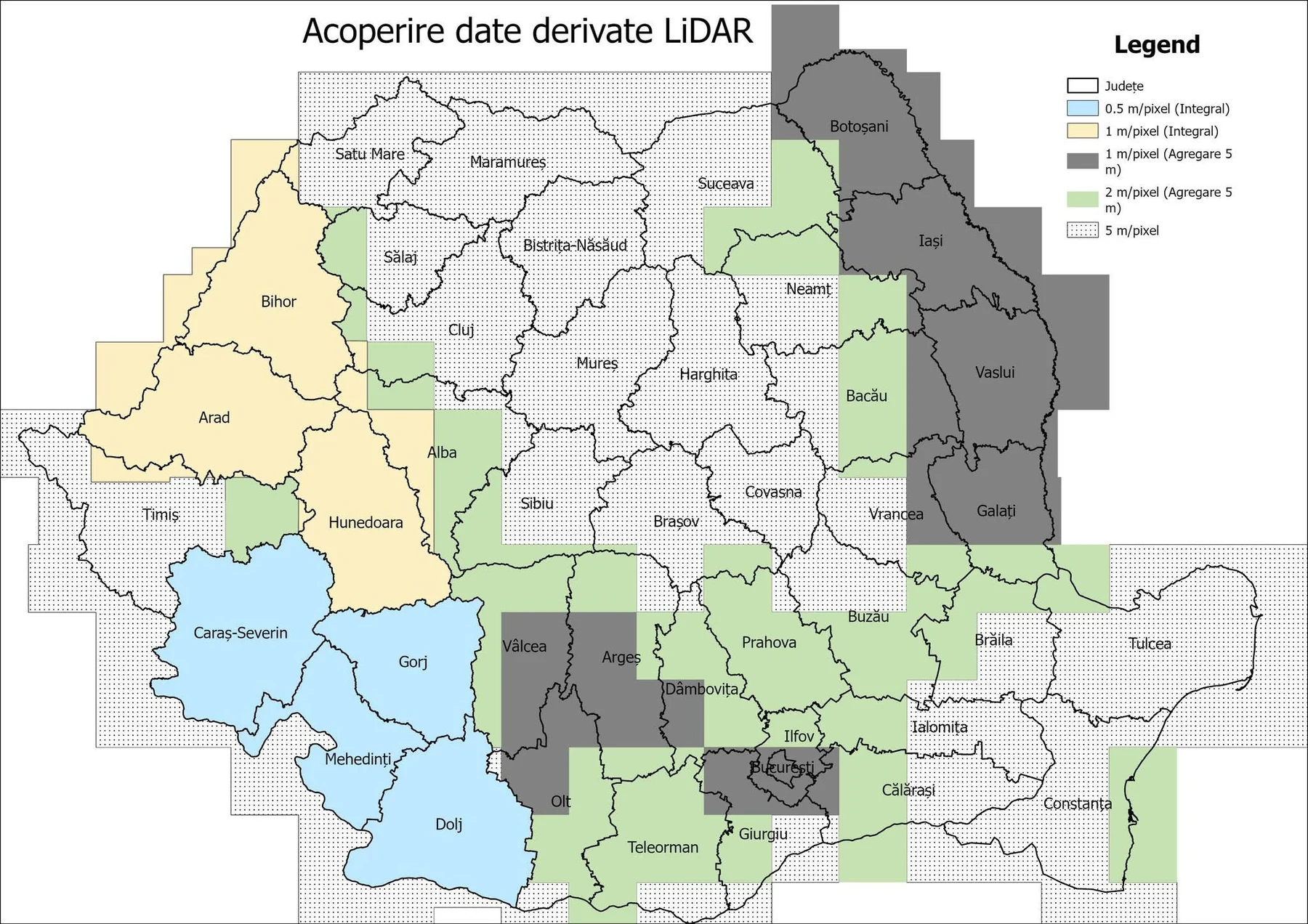
Underlying public-source elevation data are not proprietary GeoScreening data. Source rights, coverage and resolution remain those of the original provider. GeoScreening services cover preparation, processing, analysis and expert interpretation, with source attribution retained.
FROM SOURCE TO UNDERSTANDING
Public / source data → raw DTM
Mosaic → clip → reproject → prepared DTM
Terrain derivatives → geomorphometry → hydrology
Terrain intelligence → archaeological terrain analysis → expert interpretation
THE TERRAIN PRODUCT CHAIN
Public / source data → raw DTM → mosaic → clip → reproject → prepared DTM. We document the source, available coverage, coordinate system and agreed delivery resolution.
DTM, hillshade, slope, aspect and contours. Multidirectional hillshade provides a first view of surface form; numerical derivatives support further GIS analysis.
Sky-view factor, positive and negative openness, local dominance, local relief models and multi-scale terrain visualisation. Composite visualisations and QGIS-ready layers are prepared to the agreed scope.
Geomorphometry and hydrology: curvature, roughness, TPI, TRI, geomorphons, flow and landform analysis. Interpretation depends on resolution, processing scale and source quality.
Targeted multi-scale derivatives, spatial comparison and candidate feature mapping. Products support archaeological assessment without treating every terrain anomaly as archaeology.
Specialist assessment brings the terrain evidence together with landscape context and available records. The scope, confidence statements and reporting format are agreed separately. A minimum project fee applies.
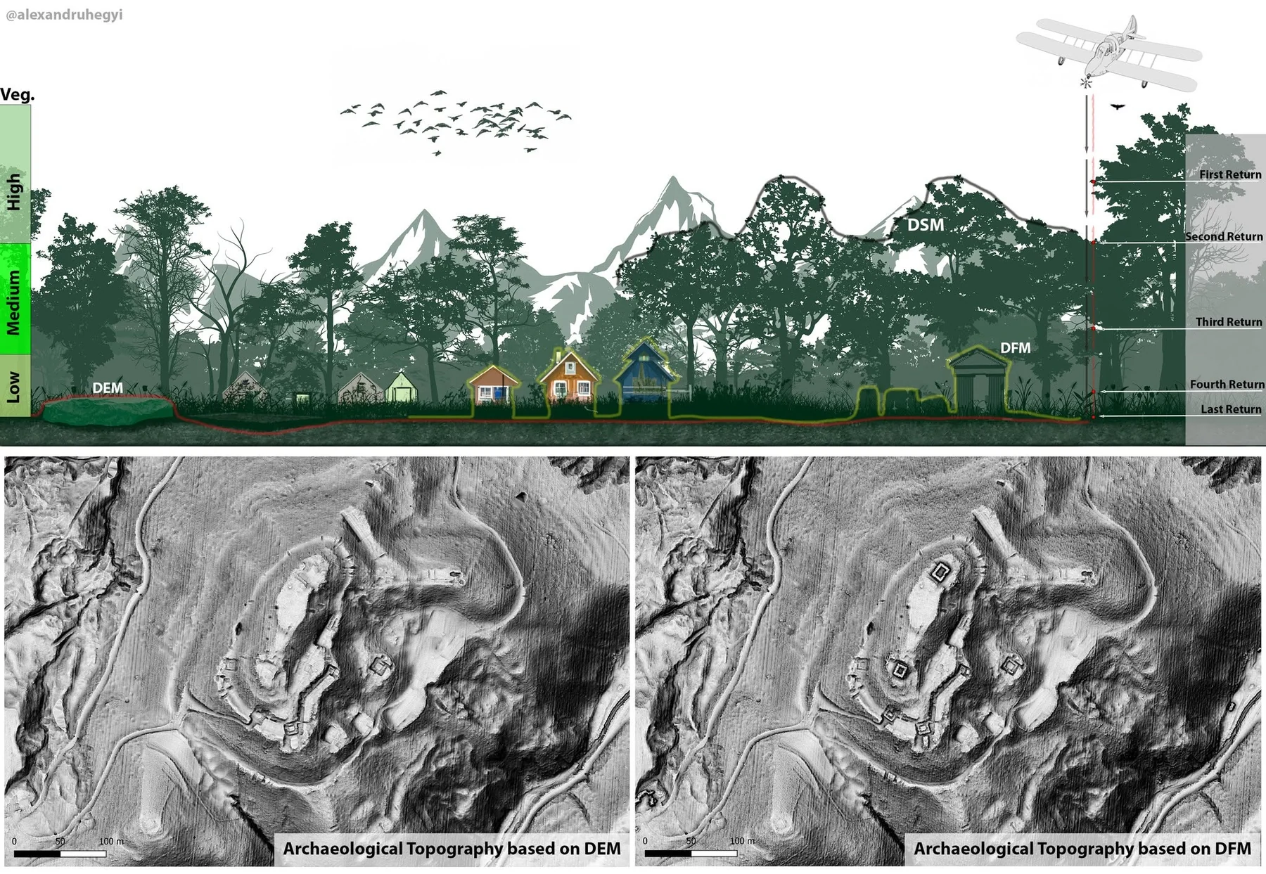
Automated terrain anomalies are not automatically confirmed archaeological features. Interpretation requires context, source assessment and, where appropriate, field verification.
Clear scope. Clear costs.
Prices exclude VAT where applicable. Final scope and price are agreed after reviewing your data.
| Dataset / scope | Indicative price |
|---|---|
| Source DTM delivery | €1–2/km² · min. €149 |
| Mosaic + clip + reproject | €3/km² |
| Terrain Essentials | €5/km² |
| Enhanced Terrain / RVT | €10/km² |
| Terrain Intelligence | €15–25/km² |
| Archaeological terrain analysis | €25–40/km² |
| Expert archaeological terrain assessment | from €50–70/km² |
Indicative rates depend on source coverage, resolution, area, data volume and required outputs. Source DTM delivery has a €149 minimum order. Expert archaeological terrain assessment has a minimum project fee, agreed in the quotation.
Minimum order value is €149 for all services, including DTM download, preparation and processing. Listed component rates below this amount apply only when the total agreed order is at least €149. Priority processing +25%; urgent delivery under 48 hours +50%, subject to availability and agreed feasibility. Unstructured, damaged or undocumented data are quoted after inspection. Massive or very dense datasets require a quotation. Revisions beyond the agreed scope are charged at the agreed hourly rate.
Contact
A sample dataset. A technical question. A result you need.