
Point-cloud preparation
LAS, LAZ, E57, XYZ and PLY. Cleaning, outlier and noise removal, merging, tiling, reprojection and thinning, with checks on point density, units and coordinate reference.
GEOSCREENING / Services
Point clouds and drone imagery transformed into terrain, surface and 3D products.
Point-cloud processing
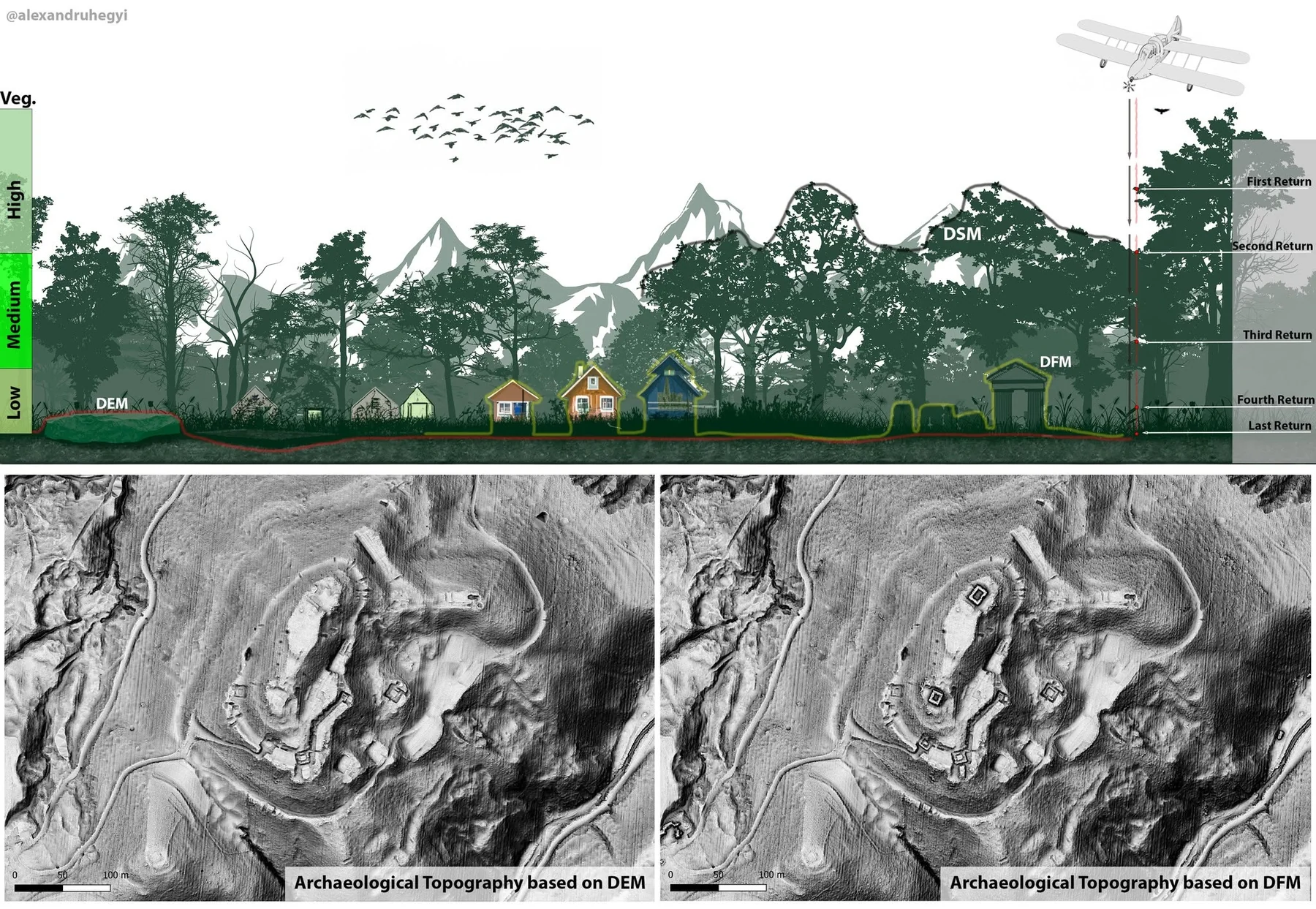
Clean geometry, appropriate classification and traceable terrain products. Point count, density and landscape complexity shape the workflow.
LAS, LAZ, E57, XYZ and PLY. Cleaning, outlier and noise removal, merging, tiling, reprojection and thinning, with checks on point density, units and coordinate reference.
Ground, vegetation, buildings, noise and other technically appropriate classes. Classification choices and quality checks reflect the sensor, landscape and required products.
DTM, DSM, normalised DSM, canopy-height models (CHM), intensity, density, contours, slope and hillshade. A terrain model requires enough reliable ground observations.
Photogrammetry
Image alignment, point cloud, orthomosaic, DSM, mesh and 3D model, with DTM extraction where technically possible. GCP / RTK adjustment, contours, GIS outputs, volumes and QC are scoped to the project.
A DTM cannot recover ground that was not observed beneath dense vegetation. We review feasibility before agreeing the product set.
Clear scope. Clear costs.
Prices exclude VAT where applicable. Final scope and price are agreed after reviewing your data.
| Dataset / scope | Indicative price |
|---|---|
| Point-cloud processing | from €149/project |
| Ground classification | €15–25/km² |
| Full classification | €25–35/km² |
| DTM / DSM generation | from €199/project |
| Forestry / canopy processing | €30–45/km² |
| Advanced / custom point clouds | On quotation |
| Dataset / scope | Indicative price |
|---|---|
| ≤500 images | from €149 |
| 500–2,000 images | from €249 |
| 2,000–5,000 images | from €399 |
| >5,000 images | On quotation |
| Dataset / scope | Indicative price |
|---|---|
| ≤500 images | from €199 |
| 500–2,000 images | from €349 |
| 2,000–5,000 images | from €549 |
| >5,000 images | On quotation |
Density, point count, image quality and complexity influence price. Full photogrammetry scope is agreed before processing. GCP / RTK adjustment and QA, DTM extraction, contours, volume calculation and 3D / web delivery are optional add-ons quoted to scope.
Minimum order value is €149 for all services, including DTM download, preparation and processing. Listed component rates below this amount apply only when the total agreed order is at least €149. Priority processing +25%; urgent delivery under 48 hours +50%, subject to availability and agreed feasibility. Unstructured, damaged or undocumented data are quoted after inspection. Massive or very dense datasets require a quotation. Revisions beyond the agreed scope are charged at the agreed hourly rate.
Contact
A sample dataset. A technical question. A result you need.